Published: April 8, 2026
Table of Contents (see Fujisan Climb Official Site)
Quick Answer: Can You Hike Mount Fuji?
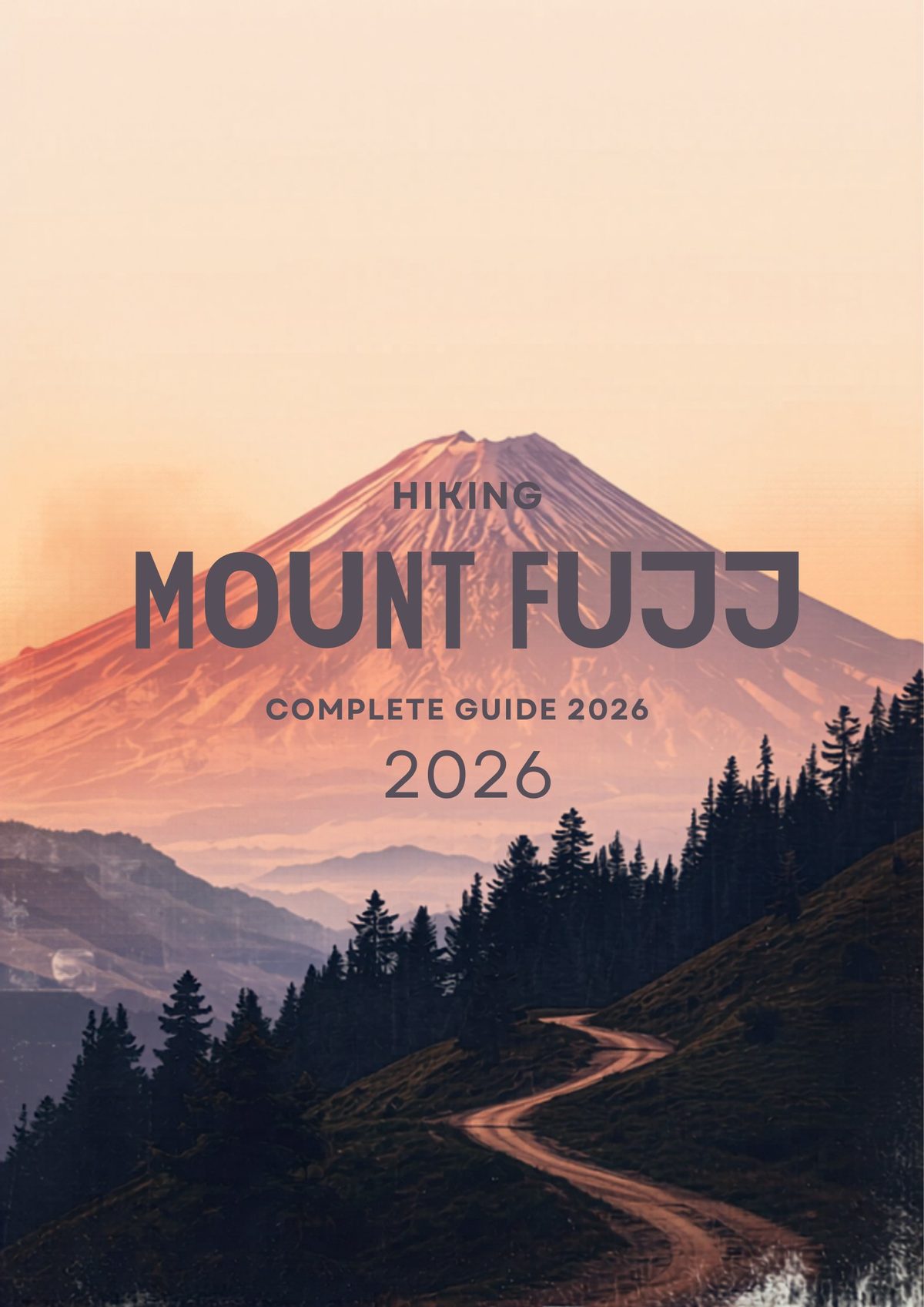
I have stood on Mount Fuji’s summit three times, and I can tell you definitively: yes, you can hike Mount Fuji, but preparation determines whether you enjoy the experience or endure it. Each year, roughly 300,000 people from around the world attempt this iconic climb during the narrow window when trails are free of snow.
The climbing season runs from early July through early September 2026. Outside these dates, the mountain is technically closed to hikers due to dangerous ice and rockfall conditions. You have two primary strategies for hiking mount fuji: the popular overnight ascent with sunrise viewing, or the grueling single-day “bullet climb” that tests even experienced trekkers.
The overnight approach remains the preferred mount fuji hiking guide recommendation. You arrive at the 5th Station in the early afternoon, climb 4-5 hours to a mountain hut between the 7th and 8th stations, catch a few hours of sleep, then wake around 1:00 AM for the final push to catch the goraiko (sunrise) from 3,776 meters. The bullet climb—starting from the 5th Station around 10:00 PM and climbing through the night without rest—saves money but significantly increases altitude sickness risk.
Mount Fuji at a Glance
Before you lace up your boots, understand exactly what you are attempting. Mount Fuji is not a technical climb, but it is a serious high-altitude hike that demands respect.
Key Facts
| Attribute | Details |
|---|---|
| Summit Elevation | 3,776 meters (12,388 feet) |
| 2026 Climbing Season | July 1 – September 10, 2026 (trail-dependent) |
| Number of Trails | 4 main routes to summit |
| Average Ascent Time | 5-8 hours (depending on trail) |
| Average Descent Time | 3-5 hours |
| Conservation Fee | ¥2,000 ($13 USD) per person |
The Four Trails at a Glance
| Trail | Distance (one way) | Elevation Gain | Difficulty | Crowd Level |
|---|---|---|---|---|
| Yoshida | 7.0 km | 1,470m | Moderate | Very High (60% of climbers) |
| Subashiri | 7.5 km | 1,780m | Moderate-Hard | Medium |
| Gotemba | 10.0 km | 2,300m | Hard | Low |
| Fujinomiya | 4.3 km | 1,330m | Hard (steep) | Medium-High |
When to Climb: 2026 Season Dates
Timing your Mount Fuji hiking trail selection depends heavily on when you visit. The 2026 mount fuji climbing season follows predictable patterns, though exact opening dates shift slightly based on snowmelt.
Official 2026 Opening Dates
The Yoshida Trail typically opens first due to its popularity and infrastructure. For 2026, expect these approximate dates:
- Yoshida Trail: July 1, 2026
- Subashiri Trail: July 10, 2026
- Gotemba Trail: July 10, 2026
- Fujinomiya Trail: July 10, 2026
All trails close around September 10, 2026, though mountain huts begin shutting down in late August.
Best Weeks to Climb
If your schedule allows flexibility, avoid weekends and the Japanese Obon holiday (mid-August 2026). I recommend targeting mid-July or late August weekdays. Early July offers hard-packed snow near the summit for dramatic photos, while late August provides the most stable weather.
Mid-week climbing (Tuesday through Thursday) reduces crowds by approximately 40% compared to weekends. The Yoshida Trail 5th Station feels chaotic on Saturday mornings, with hour-long waits for toilets and packed mountain huts.
Weather Patterns and Typhoon Season
Even during summer, temperatures at the summit hover near freezing (0°C to 5°C / 32°F to 41°F). August brings the highest risk of typhoons, which can shut down trails for 24-48 hours. Check the Japan Meteorological Agency forecast daily during your climb window.
Afternoon thunderstorms pose the greatest immediate danger. The rule is simple: if you hear thunder below the 8th station, descend immediately. The mountain’s volcanic rock conducts electricity, making lightning strikes a genuine hazard.
The 4 Trails Compared
Choosing your mount fuji hiking trail shapes your entire experience. Each route offers distinct advantages regarding scenery, difficulty, and solitude.
Yoshida Trail (Most Popular)
The Yoshida Trail handles 60% of all climbers for good reason. Starting from the Fuji-Subaru Line 5th Station (2,305m), it offers the most mountain huts, clearest signage, and easiest access from Tokyo. The ascent takes 5-7 hours, while the descent follows a separate path of zigzagging volcanic gravel that takes 3-4 hours.
I recommend the Yoshida Trail for first-time climbers and those seeking the classic Mount Fuji experience. However, expect congestion near the summit between 3:00-5:00 AM. The trail merges with the Subashiri route at the 8th station, creating bottlenecks.
Subashiri Trail
The Subashiri Trail starts lower (1,970m) on the eastern side, meaning a longer climb but more gradual acclimatization. The trail passes through forest before emerging onto volcanic terrain. It joins the Yoshida Trail at the 8th station, so you still experience the crowded summit push.
This route suits climbers wanting a quieter start without sacrificing the Yoshida Trail’s infrastructure. The descent route differs from ascent, offering pleasant volcanic sand running sections that save knee strain.
Gotemba Trail (The Challenge)
For experienced hikers seeking solitude, the Gotemba Trail delivers. At 10 kilometers one-way with 2,300 meters of elevation gain, it is the longest and least crowded route. The trail starts at Gotemba 5th Station (1,440m), requiring serious stamina.
I climbed Gotemba in 2023 and encountered perhaps 50 other people total. The trade-off? Fewer huts (bring extra water) and a brutal final ascent. This trail suits strong hikers who prioritize quiet over convenience.
Fujinomiya Trail (Short but Steep)
The Fujinomiya Trail offers the shortest distance (4.3km) but steepest gradient. Starting from Fujinomiya 5th Station (2,400m), it attracts climbers from Osaka, Kyoto, and western Japan. The ascent and descent share the same path, creating dangerous two-way traffic during peak hours.
This trail works well for experienced climbers short on time, but the lack of a separate descent route means enduring loose scree both ways. The views toward the Pacific Ocean and Izu Peninsula are spectacular on clear days.
Detailed Trail Comparison
| Trail | 5th Station Access | Ascent Time | Descent Time | Best For |
|---|---|---|---|---|
| Yoshida | Direct bus from Shinjuku (2.5 hrs) | 5-7 hours | 3-4 hours | First-timers, sunrise chasers |
| Subashiri | Bus from Gotemba or Shin-Matsuda | 6-8 hours | 3-4 hours | Forest scenery lovers |
| Gotemba | Bus from Gotemba Station (1 hr) | 7-10 hours | 3-5 hours | Experienced hikers, solitude seekers |
| Fujinomiya | Bus from Fujinomiya/Shin-Fuji | 4-6 hours | 2-3 hours | Strong climbers, short itineraries |
What to Pack: Complete Mount Fuji Gear List
Your mount fuji gear list separates an enjoyable summit from a miserable suffer-fest. Weather changes rapidly, and temperatures drop 6°C per 1,000 meters gained.
Essential Gear
| Item | Why You Need It | Approximate Cost (Buy) |
|---|---|---|
| Hiking Boots | Ankle support for loose volcanic rock | ¥15,000-¥40,000 ($100-$265) |
| Headlamp + Batteries | Night climbing essential (hands-free) | ¥3,000-¥8,000 ($20-$53) |
| Rain Gear (Jacket & Pants) | Afternoon storms, wind protection | ¥10,000-¥30,000 ($65-$200) |
| Base Layers | Merino wool or synthetic (no cotton) | ¥5,000-¥12,000 ($33-$80) |
| Insulating Layer | Down or synthetic puffer jacket | ¥8,000-¥25,000 ($53-$165) |
| Gloves & Warm Hat | Summit temperatures near freezing | ¥2,000-¥5,000 ($13-$33) |
| Backpack (25-35L) | Water, snacks, extra layers | ¥8,000-¥20,000 ($53-$130) |
| Cash (¥10,000+) | Mountain huts are cash-only | N/A |
Nice-to-Have Items
- Trekking poles: Save your knees during descent (¥3,000-¥10,000)
- Gaiters: Keep volcanic dust out of boots
- Sunglasses & sunscreen: UV intensity increases at altitude
- Portable oxygen canister: Available at 5th Station for ¥1,500 ($10)
- Earplugs: Mountain huts are noisy with 100+ snorers
What NOT to Bring
Leave the cotton t-shirts, jeans, and fashion sneakers at your hotel. Cotton kills in alpine environments—it retains moisture and accelerates hypothermia. Also avoid heavy DSLR cameras unless you are a serious photographer; your phone handles summit photos adequately, and every gram counts at 3,700 meters.
Mountain Huts: Where to Sleep
Understanding fuji mountain hut logistics proves crucial for the overnight climbing strategy. These basic shelters sit between the 7th and 8th stations (2,700m-3,100m), offering futons, dinner, and breakfast to break your climb into manageable segments.
Why Stay in a Mountain Hut?
Most climbers cannot complete the round-trip from 5th Station to summit and back in daylight hours. More importantly, arriving at the summit 3-4 hours before sunrise leaves you exposed to freezing winds with nowhere warm to wait. The mountain hut strategy allows you to climb 4-5 hours in afternoon light, sleep 4-5 hours, then summit 1-2 hours before dawn.
Top Mountain Huts on Yoshida Trail
Book these immediately when reservations open (typically April 2026 for the July season):
- Taishikan (8th Station): ¥9,000 ($60) including dinner and breakfast. Clean facilities, excellent curry rice.
- Goraiko-kan (8th Station): ¥8,500 ($56) with private room options available.
- Horaikan (7.5 Station): ¥7,500 ($50) basic but friendly English-speaking staff.
- Ikeda-kan (7th Station): ¥7,000 ($46) budget option, often has last-minute spots.
Booking Process
Mountain huts open reservations in spring 2026. The best huts sell out for August weekends within days. Book directly through Japanese websites (use Google Translate) or via Japan travel guide“>travel agents specializing in Japan.
Expect a spartan experience: futons crammed side-by-side in tatami rooms, lights out at 8:00 PM, and wake-up calls at 1:00 AM. Dinner is typically curry rice or noodles served at 4:00 PM; breakfast is rice balls eaten at 1:30 AM before departure.
The Climb: Hour-by-Hour Timeline
Here is exactly how your mount fuji hiking guide schedule should look for the standard overnight ascent via Yoshida Trail:
Day 1: The Ascent
11:00 AM – Arrive at 5th Station
Acclimatize for one hour. Walk around, use restrooms (¥200/$1.30 per use), buy last-minute supplies, and pay the ¥2,000 conservation fee. Eat a substantial lunch here; your next real meal is dinner at the hut.
12:00 PM – Begin Climbing
The trail starts gentle but steepens quickly. You will reach the 6th Station (2,400m) in about one hour. This section has shade and restrooms.
2:00 PM – 7th Station (2,700m)
Terrain becomes rocky and exposed. Rest stops feature basic shops selling water (¥500/$3.30 per bottle) and ramen (¥1,000/$6.60). Pace yourself; “climb high, sleep low” does not apply here, so steady progress prevents altitude sickness.
4:00 PM – Arrive at Mountain Hut (7.5th-8th Station)
Check in, drop your pack, and rest. Dinner service starts around 4:30 PM. Sleep by 8:00 PM.
Day 2: The Summit Push
1:00 AM – Wake Up
Quick breakfast, gear up with headlamps. The trail is already lit like a string of pearls from hundreds of other headlamps.
1:30 AM – Depart Hut
The final 500 meters of elevation gain take 2-3 hours due to altitude and crowds. The air thins significantly above 3,000 meters.
3:30-4:00 AM – Summit (3,776m)
Find your spot at the crater rim. The torii gate marks the official top. Temperatures hover around 0°C (32°F); put on every layer you carry.
4:30-5:00 AM – Sunrise (Goraiko)
The main event. As the sun breaks the horizon, the shadow of Mount Fuji casts perfectly across the clouds below—a phenomenon visible only from the summit.
6:00 AM – Begin Descent
The Yoshida descent route splits from the ascent path at the 8th Station. This “sand run” section allows fast downhill movement but wrecks knees.
9:00-10:00 AM – Return to 5th Station
Collect your bus or car. You will be dusty, exhausted, and elated.
Watching Sunrise from the Summit
The goraiko (sunrise) represents the payoff for hiking mount fuji. Standing on Japan’s roof as dawn breaks creates a spiritual moment that explains why this mountain has inspired pilgrims for centuries.
Finding the Best Position
The Yoshida Trail deposits you at the crater rim near the weather station. Walk counter-clockwise around the crater (the ohachi-meguri circuit) to find less crowded viewpoints. The Kengamine peak (3,776m) offers the highest point but requires a 30-minute scramble along the crater rim.
Arrive at the summit by 4:00 AM to secure a spot. The area around the summit torii gate becomes impossibly crowded by 4:30 AM. Bring a foam sit pad—the volcanic rock is cold and jagged.
Photography Tips
Mount Fuji creates a perfect triangular shadow across the cloud sea at sunrise, visible looking west while the sun rises east. Use a smartphone panorama mode to capture the 360-degree view encompassing the Southern Alps, Tokyo (on clear days), and the Pacific Ocean.
Keep spare batteries warm in your jacket; cold drains power quickly. Avoid drone usage—it is prohibited and dangerous in high winds.
The Crater Walk (Ohachi-Meguri)
If energy permits, walk the crater rim circuit (about 1 hour). This 3-kilometer path circles the volcanic crater, offering views into the dormant cone and across to Hoeizan, the secondary peak formed during the 1707 eruption. Most climbers skip this, so you will find solitude here even on crowded days.
Getting to Mount Fuji 5th Station
Logistics determine whether your climbing mount fuji adventure starts smoothly or stressfully. The Yoshida Trail 5th Station requires specific planning.
From Tokyo: The Shinjuku Bus
The most direct route runs from Shinjuku Expressway Bus Terminal to Yoshida 5th Station. In 2026, buses depart at 6:15 AM, 7:45 AM, 9:15 AM, and 11:45 AM. The journey takes 2 hours 30 minutes and costs ¥2,950 ($19.50) one-way.
Book tickets online through Highway Bus Japan at least one month ahead for August dates. Same-day tickets often sell out by 9:00 AM.
Via Kawaguchiko
If you stay in the Fuji Five Lakes region (recommended for acclimatization), take the Fujikyuko bus from Kawaguchiko Station to 5th Station (1 hour, ¥2,100/$14). This route offers stunning views of the mountain during approach.
Driving and Parking
Private vehicles cannot access the Yoshida 5th Station during peak season (July 20-August 31, 2026). You must park at the Fuji-Subaru Line toll road entrance (¥2,000 parking) and take a shuttle bus (¥2,100 round-trip). Outside these dates, driving to 5th Station is permitted but parking fills by 10:00 AM.
Costs: How Much Does It Cost to Climb Mount Fuji?
Budgeting for hiking mount fuji requires accounting for transportation, mandatory fees, accommodation, and mountain sustenance. Here is the complete 2026 price breakdown:
Mandatory and Variable CostsMore on Hiking & Nature:

Written by Sam Konneh
Sam Konneh is an AI strategist and digital marketer based in Seoul, South Korea. With years spent living, working, and exploring across Korea, Japan, and China, he shares firsthand insights into East Asia's cultures, hidden gems, and everyday life. A graduate of Inha University and KDI Graduate School, Sam combines data-driven expertise with on-the-ground experience. His journey also includes studying in Malaysia and traveling through Southeast Asia. Through practical tips, local stories, and travel guides, he helps fellow explorers discover both the celebrated highlights and the lesser-known corners of East Asia.
More on Hiking & Nature:
Written by Sam Konneh
Sam Konneh is an AI strategist and digital marketer based in Seoul, South Korea. With years spent living, working, and exploring across Korea, Japan, and China, he shares firsthand insights into East Asia's cultures, hidden gems, and everyday life. A graduate of Inha University and KDI Graduate School, Sam combines data-driven expertise with on-the-ground experience. His journey also includes studying in Malaysia and traveling through Southeast Asia. Through practical tips, local stories, and travel guides, he helps fellow explorers discover both the celebrated highlights and the lesser-known corners of East Asia.
