Last Updated: October 2, 2026 | Originally Published: November 26, 2024
Quick Answer: Japanese Addresses in 30 Seconds
- Japan has no sequential street-number grid — buildings are numbered by chome (neighborhood) → ban (block) → go (building), usually in construction order, not geographic order.
- Every address carries a 7-digit postal code (e.g., 105-0011 for Minato City) issued by Japan Post — enter it into Google Maps or a taxi GPS and it narrows the search to a single block before you add the chome-ban-go.
- Couriers like Yamato Transport (Kuroneko Yamato) and Sagawa Express navigate this system daily using the postal code plus a phone call to confirm the building — the same workaround works for visitors.
- South Korea abandoned a similar block-based system in 2014 for Western-style road-name addresses — Japan did not, which is why GPS coordinates or Plus Codes often beat the written address.
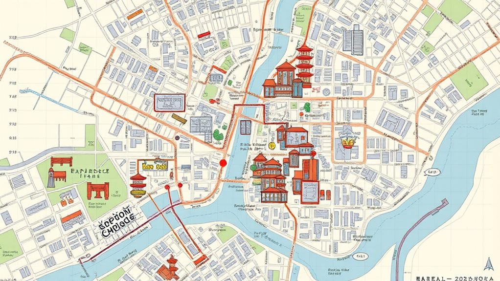
Understanding Japan’s unique address system is key to getting around the country. Neighborhoods, called “chome,” have distinct identities, while “ku” districts encompass multiple neighborhoods. Buildings are numbered based on construction order, following a clockwise pattern. Streets often lack official names, so you’ll need to reference neighborhoods and districts instead. Major cities have intricate address components, from prefecture to building number. Even rural areas have a structured system, using neighborhood and block numbers. Mastering these address elements will make your travels in Japan much smoother. And with helpful apps providing bilingual address information, you’ll feel right at home finding your way around Japan’s streets. (Source: Japan National Tourism Organization)
Read our full Japan Travel Guide 2026 for everything you need to plan your Japan trip.
Explorer Insights
- Japan’s address system is based on neighborhoods (chome), blocks (ban), and building numbers rather than a straightforward street grid layout.
- Understanding the hierarchical structure of neighborhoods, districts, and building numbering conventions is important for effective navigation in Japanese cities.
- Real-time transportation information and bilingual maps or apps can assist visitors in planning routes and using the address system effectively.
- In rural and suburban areas, addresses are composed of the neighborhood, block, and building number, which can be helpful to know when asking for directions.
- Familiarizing oneself with the order and purpose of address components, such as prefecture, city, and building number, can improve navigation and communication when traveling in Japan.
Neighborhood and District Structure
In Japan, neighborhoods and districts are the fundamental building blocks of the address system. These geographic divisions provide the essential information needed to navigate the country efficiently. (see Japan Guide)
Pro Tip: Save the 7-digit postal code, not just the chome-ban-go, into your phone. Taxi drivers and rental-car GPS units in Japan are built around the postal code lookup (〒 system), and it narrows a search to a single block before you even mention the neighborhood name.
Neighborhoods, or “chome,” are the smallest administrative units, with distinct boundaries that residents know well. Chome are often characterized by a particular style of architecture, shops, or community identity. (see Hyperdia train schedule tool)
Districts, or “ku,” encompass several neighborhoods and serve as the next level in the address hierarchy. Ku can vary greatly in size and population, from densely populated urban areas to more sparsely inhabited suburbs. (see Lonely Planet Japan guide)
Understanding the neighborhood and district structure matters for getting around Japan. Locals rely on these geographic markers to provide directions, so familiarizing yourself with the system will make navigation a breeze. Pay attention to the chome and ku as you explore, and you’ll quickly get a feel for the unique character of each area.
Building Numbers and Block Organization
Alongside the neighborhood and district structure, building numbers and block organization form a important aspect of Japan’s address system. Buildings are typically numbered in the order they were constructed within a city block, with the lowest numbers assigned to the structures closest to the main intersection. This numbering system can feel confusing at first, as the addresses don’t follow a linear progression. However, with a bit of practice, you’ll get the hang of managing these unique address components.
Within a given block, buildings are arranged in a clockwise pattern, with the smallest address numbers at the corner closest to the main intersection. As you move around the block, the address numbers gradually increase. Pay close attention to this layout, and you’ll be able to pinpoint the exact location of your destination with ease.
Tokyo’s subway system is well-integrated with other rail systems, enabling access to almost any part of the metropolis, which can be helpful when traversing the city’s unique address system. Mastering Japan’s building number and block organization will make your navigation experience much smoother and more efficient.
Street Naming Conventions
Japan’s street naming conventions can seem quite different from what you may be accustomed to. Instead of logical, grid-like patterns, the streets often wind and curve, with addresses assigned based on the order in which buildings were constructed rather than their physical location. Using a map app or asking locals for directions can help navigate the complex addressing system.
Many streets don’t even have official names, referred to instead by the neighborhood or district they’re in. And when streets do have names, they may use Japanese words or historical references that can be tricky for non-native speakers to decipher.
The good news is that most major roads and tourist areas will have bilingual street signs, making navigation a bit easier. Additionally, many maps and apps now offer both Japanese and English address information. By familiarizing yourself with these unique conventions, you’ll be better prepared to find your way around Japan’s urban fields.
Urban Planning and Address Development
Underpinning Japan’s unique address system is a long history of urban planning and address development that has evolved over centuries. From the ordered grid layouts of Kyoto to the winding streets of Tokyo, Japanese cities reflect a meticulous approach to spatial organization.
As populations grew, address systems adapted to accommodate the changing urban field. Many towns and cities are divided into distinct neighborhoods called chome, with each chome further divided into smaller blocks known as ban or gochi. This hierarchical structure allows for precise location identification, though it can be challenging for first-time visitors.
Keeping a map handy and familiarizing yourself with the local address format can make traversing these systems much easier. Additionally, the Japan Official Travel App provides detailed transportation schedules and route planning to assist travelers.
Understanding the principles behind Japan’s address development provides valuable context for making the most of your travels. By appreciating the historical and cultural factors shaping these systems, you’ll gain a deeper appreciation for the intricate urban fields you explore.
Postal Codes and How Couriers Actually Find You
The piece most guides skip: every Japanese address carries a 7-digit postal code (〒, yubin bango), written as three digits, a hyphen, then four — for example 105-0011, the code for Minato City’s Tokyo Tower area. Japan Post’s own lookup tool, post.japanpost.jp/zipcode, converts a postal code straight to the ward and neighborhood name — useful when a hotel or Airbnb listing gives you the code but not a readable address.
This is also how delivery actually works at scale. Yamato Transport (Kuroneko Yamato) and Sagawa Express, Japan’s two largest courier networks, route by postal code plus chome-ban-go, and drivers routinely call ahead to confirm the building when the go (building number) isn’t visible from the street — the same phone-assisted approach works for a visitor using a hotel concierge or a translation app.
| System | How it’s organized | Still in use? |
|---|---|---|
| Japan (chome-ban-go) | Neighborhood → block → building, numbered by construction order | Yes, nationwide since the system’s modern form took shape post-WWII |
| South Korea (road-name address) | Street name → sequential building number, Western-style | Yes — replaced the old lot-number (jibun) system as the legal standard in 2014 |
| United States / grid systems | Street name → sequential number by geographic position | Yes, standard |
Warning: Don’t assume a low building number means “close to the last one you passed.” Because go numbers follow construction order, not position, 7-ban can sit directly across the street from 2-ban. Always confirm with the postal code or GPS pin, not sequential logic.
Addressing in Major Japanese Cities

Major Japanese cities have distinct addressing systems that can take some getting used to for first-time visitors. Unlike the straightforward street numbers and grid systems common in North America, Japanese addresses follow a more complex logic. In Tokyo, for example, addresses are based on the neighborhood (chome), block (ban), and building number (go), rather than a sequential street address. This can make getting around the city a bit tricky at first — Tokyo Tower itself sits at 4-2-8 Shibakoen, Minato City, postal code 105-0011, which is a cleaner starting point for a map search than the street it fronts.
Real-time train delay information can be particularly helpful in avoiding delays when maneuvering the city’s transportation network.
However, don’t let this unique system intimidate you. With a little preparation, you’ll be finding your way around like a local. Start by familiarizing yourself with the general layout of the city and the major neighborhoods. Many maps and navigation apps now include Japanese address information to help you plan your route. And once you’re on the ground, don’t hesitate to ask for directions from friendly locals – they’re often happy to point you in the right direction.
Rural and Suburban Address Systems
Rural and suburban areas in Japan employ a distinct addressing system that may initially puzzle those accustomed to more straightforward approaches. Instead of street names and house numbers, you’ll encounter a system based on neighborhoods, blocks, and individual buildings. The first number identifies the neighborhood, followed by the block number, and finally the building number. This can take some getting used to, but with a bit of practice, you’ll find it’s actually quite logical and efficient.
Arrival times are punctual on Shinkansen trains, so being familiar with the address system can help avoid rushing. One helpful tip is to pay attention to the local maps, which often include this address information. Knowing the neighborhood and block numbers can make it much easier to navigate, even if you’re not familiar with the specific building. Additionally, don’t be afraid to ask locals for directions – they’re usually happy to point you in the right direction using the neighborhood and block system.
Understanding Address Components
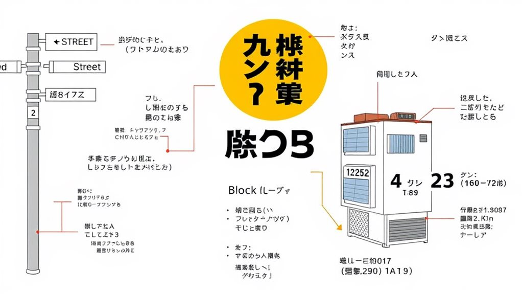
Understanding the individual components of a Japanese address is the key to traversing this system effectively. Each element serves a specific purpose, and once you grasp their function, maneuvering Japan becomes much more straightforward.
The first part is the prefecture, which is the larger regional division. Next, you have the city or town, followed by the ward or district within that city. The street name and building number come after that. Finally, the apartment or unit number, if applicable, completes the address.
Pay close attention to the order, as it differs from Western conventions. Start broad with the prefecture, then narrow down to the specific location. When providing your address, be sure to list the components in this logical sequence. With a bit of practice, you’ll be negotiating Japan’s address system like a pro in no time.
Navigating With Japanese Addresses
Traversing With Japanese Addresses
Traversing Japan’s address system can be a breeze once you grasp the basics. Maneuvering with Japanese addresses is all about understanding the different components and their order. First, look for the prefecture, then the city or ward. Next, find the neighborhood or district, followed by the block number. Finally, locate the building and unit number. (see Japan Rail Pass official site)
Don’t worry if it seems overwhelming at first. With a little practice, you’ll be finding your way around Japan with ease. Familiarize yourself with common neighborhood and district names, and keep an eye out for landmark buildings or intersections to orient yourself. Using language apps can also be helpful when maneuvering. (see Time Out Tokyo)
When in doubt, don’t hesitate to ask locals for directions. Many are happy to assist travelers unfamiliar with the system. By combining your knowledge of address components with a bit of on-the-ground exploration, you’ll be maneuvering Japan’s streets like a pro in no time. (see MATCHA Japan Travel Guide)
Implications for Visitors and Residents
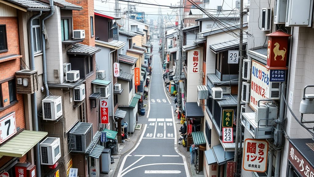
For both visitors and residents, grasping the intricacies of Japan’s address system can prove invaluable. Understanding the implications will make traversing Japan a breeze.
Japan’s addresses are organized by neighborhood, not street name, which can be confusing for first-time visitors. Knowing this can help you find your destination more easily. Carrying a translated card explaining any dietary restrictions or allergies can also be helpful when maneuvering menus. Addresses also include building and apartment numbers, so you’ll need to pay close attention to these details when giving or following directions.
Residents often rely on landmarks and neighborhood names rather than street addresses, so don’t be afraid to ask locals for guidance. Many maps and navigation apps may not accurately reflect Japan’s address system, so it’s best to double-check with multiple sources. Using translation apps can also help with understanding address information.
Mastering the basics of Japanese address structure can open up a world of independent exploration, allowing you to confidently find Japan’s winding streets and hidden gems.
Key Takeaway: Lead with the 7-digit postal code, then chome-ban-go, then a GPS pin or Plus Code as a backup — that order gets you found by both a Japan Post lookup and a confused taxi driver.
Frequently Asked Questions
How Do I Find a Specific Address in Japan?
To find a specific address in Japan, start by gathering key details like the prefecture, city, and street name.
Then, use online maps or address search tools to locate the address. Many Japanese addresses include neighborhood or district names, so make sure you have all the relevant information.
Once you’ve found the address, you can plan your route using public transportation or navigation apps.
With a little preparation, you’ll be able to find your destination in Japan easily!
What Are the Common Address Formats Used in Japan?
Did you know that Japan has over 127 million residents, all needing a reliable address system? No worries, though – the common formats are straightforward.
You’ll typically see addresses listed as “Prefecture, City, District, Block Number, Building Number.” Some also use the older system of “Prefecture, City, Town, Street Number.” Just ask a local for assistance traversing Japan’s addresses, and you’ll be finding your destination in no time!
How Do I Translate a Japanese Address to English?
To translate a Japanese address to English, start by identifying the key components – the prefecture, city, ward, and street name. Typically, the address is written with the largest geographical unit first, followed by the smaller units.
Pay attention to any unique numbering systems, as Japanese addresses may not follow a linear pattern like in Western countries. With a little practice, you’ll be maneuvering Japanese addresses like a pro!
Are Addresses in Rural Areas Different From Urban Areas?
Ah, that’s a great question! You’ll find that addresses in rural areas of Japan can be quite different from those in urban centers. Rural addresses often rely more on landmarks and natural features, rather than a strict grid system.
But don’t worry – with a little flexibility and an open mind, you’ll be traversing those country lanes like a pro in no time! The key is to embrace the local flavor and let the adventure unfold. You’ve got this!
How Can I Use Japanese Addresses for Navigation?
Using Japanese addresses for traversing is quite straightforward once you get the hang of it. The key is understanding the basic structure – the address starts with the largest area and gets more specific as you go.
Pay attention to the order of prefecture, city, ward, and finally the block and building number. With a little practice, you’ll be traversing Japan’s streets like a pro in no time.
Just remember to have a map or GPS handy and you’ll be all set!
What Is a Japanese Postal Code and Do I Need It?
Japan’s postal code is a 7-digit number (format NNN-NNNN, such as 105-0011) assigned by Japan Post to every neighborhood block nationwide. You need it: hotels, Airbnb hosts, and courier drivers all route by postal code first, and typing it into Google Maps narrows the search radius before you add the chome-ban-go. Look one up for free at post.japanpost.jp/zipcode.
How Do Delivery Drivers Find Addresses Without Street Names?
Yamato Transport and Sagawa Express, Japan’s largest courier networks, combine the postal code with the chome-ban-go and call the recipient’s phone when the building number isn’t visible from the road. Visitors can use the same fallback: show a taxi driver or convenience-store clerk the postal code and building name, and let them confirm by phone if needed.
Conclusion
You’ll be surprised to learn that Japan’s addresses are typically written with the largest administrative unit first, followed by smaller divisions. For instance, in Tokyo, you’d see the city’s name, then the ward, neighborhood, and finally the building number. Mastering this unique system will make traversing Japan a breeze, allowing you to find your destination quickly and efficiently. With a little practice, you’ll be exploring Japan like a local in no time!
Last updated: October 2026
More on Transportation:

Written by East Asia Explorer Editorial Team
Sam Konneh is an AI strategist and digital marketer based in Seoul, South Korea. With years spent living, working, and exploring across Korea, Japan, and China, he shares firsthand insights into East Asia's cultures, hidden gems, and everyday life. A graduate of Inha University and KDI Graduate School, Sam combines data-driven expertise with on-the-ground experience. His journey also includes studying in Malaysia and traveling through Southeast Asia. Through practical tips, local stories, and travel guides, he helps fellow explorers discover both the celebrated highlights and the lesser-known corners of East Asia.